Grande Traversée de Vaucluse Part 1
01
Part 1
The Grand Traversée de Vaucluse is one of 14 Grand Traversée routes throughout France, some more suited to the mtb, others the gravel bike. With spectacular scenery around every turn and a visit to the slopes of Mt Venoux, the GTV is an mtb adventure, following technical and flowing single-track which passes over many of the high points as well as dipping down into the deep valleys of the Vaucluse and Luberon regions. There are 2 options, the shorter ‘Hauts de Vaucluse’ at 280km or the ‘Grand Luberon’ route, at 328km with nearly 9,000m of climbing, which is the one I rode.
328km may not seem a long way for the ultra affectionados, but these are proper mtb trails with more than half the ride time along flowing single-track. Some climbs are a rewarding challenge, single tracks descents will leave you whooping at their end and the landscape changes as you head south, from the lavender fields and rocky trails of Vaucluse to the rolling hills of the Luberon. This is a ride to savour and take your time over. Tarmac is kept to an absolute minimum, linking off road sections, smoother double tracks are welcome moments to spin out the legs and gain some easier km. The GTV isn’t devoid of hike-a-bike, some of it steep, but never wasted, always leading to otherwise hidden gems of single-track.


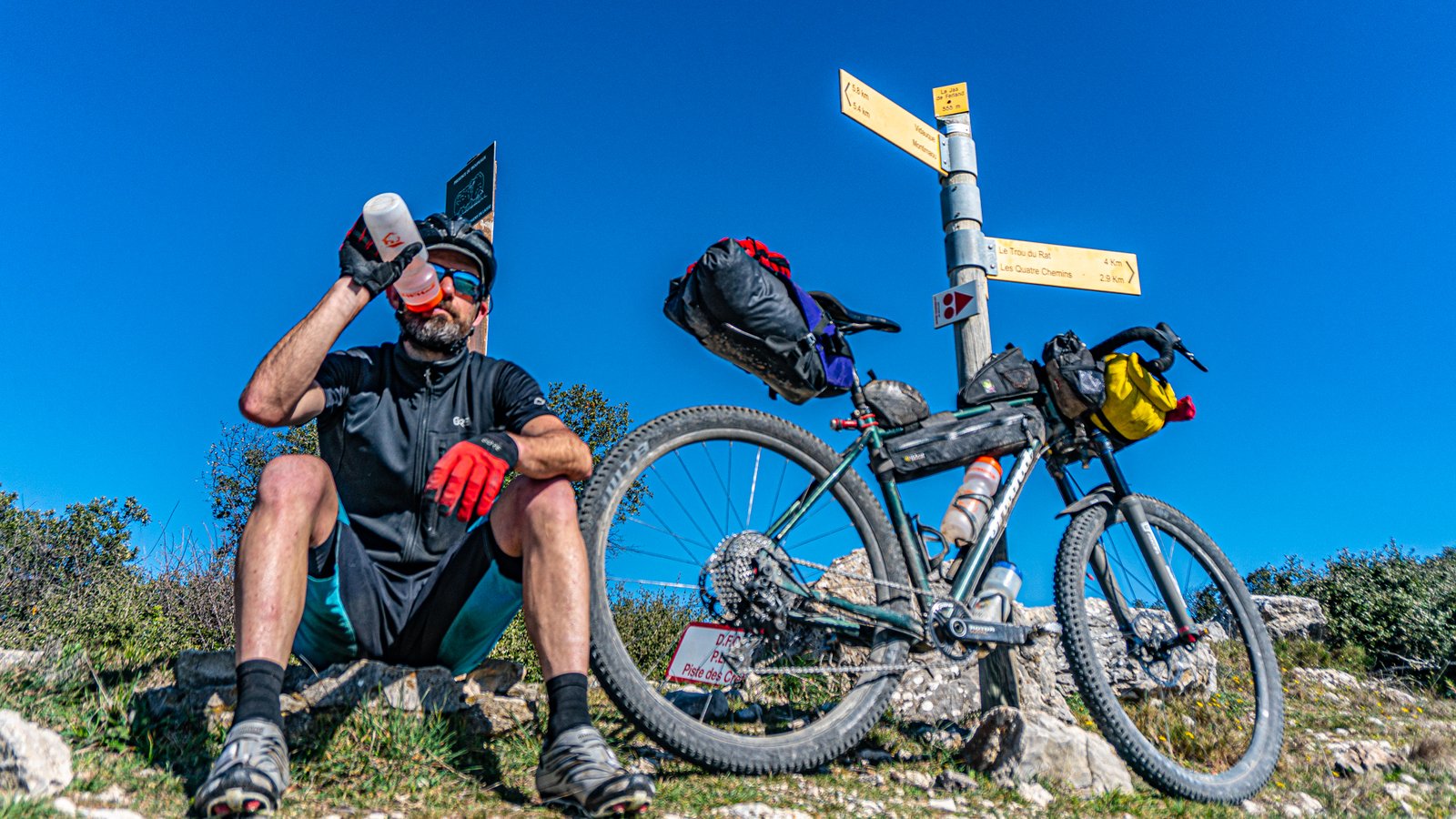
The official start for both routes is the village of Savoillan, but I started my ride furhter east in Rasteau, where a new gravel bike centre has been developed. I stayed a couple of nights at the bike friendly B&B Côté Cour in the village centre to check out the riding in the area. My hosts Monique and her husband were very welcoming, having their company at breakfast and dinner, chatting about trail riding and skiing on Mt Ventoux. The 43km ride to Savoillan was a gentle introduction to the terrain of Vaucluse, up into the hills along a rolling double track with striking views of Mt Ventoux.

02
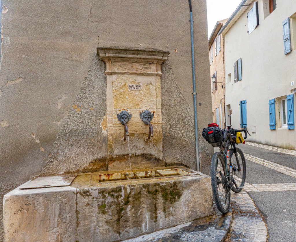
Savoillan itself is a small village limited to a water supply only from its fountain, so stock up food wise before heading out from here. Moutbrun les bains is the closest option or the larger towns of Sault and Malaucène are nearby with supermarkets, both of which the route will eventually pass through. Mid March might seem early to be bikepacking in France, but the Provençal region rarely experiences significantly cold day time temperatures (although there is a ski station on the upper reaches of Mt Ventoux) and most of the southern part of the country was experiencing warm Spring like weather conditions. The 18th curfew in place across France and being well out of season did add some logistical challenges, but one advantage was exceptionally quiet trails! July and August would be periods to avoid riding this route due to the potentially high number of hikers.
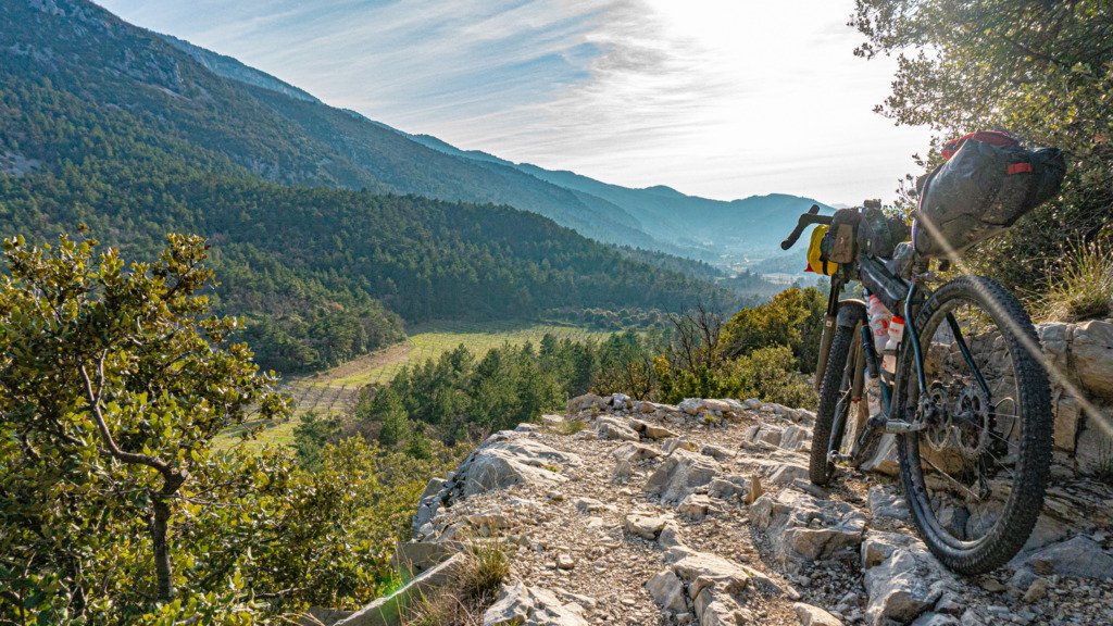
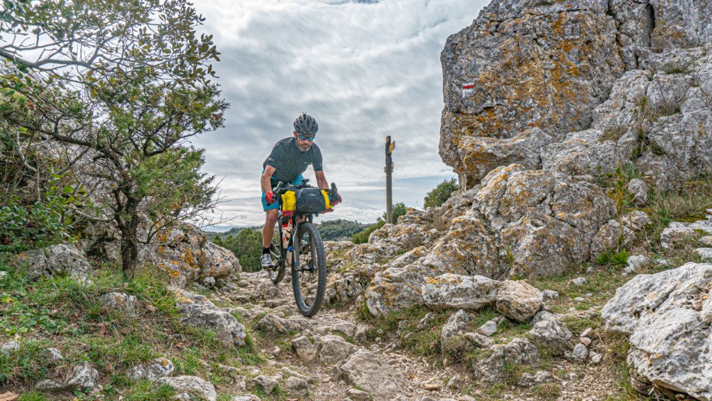
No sooner had you crossed over the stone bridge over the river and you were on the rolling tree lined trails, the early afternoon heat breaking through the dense forest. The route is well signposted with red triangular symbols, but it’s best to have the route on a gps too as a backup. Within a few kms was the first hike-a-bike, straight up a steep bank, a section of rope in situ to help people up! The loaded bike required both hand though to push it upwards, quietly glad that I had fitted the shoe studs, which provided much needed grip in the dirt (would suggest fitting shoe studs anyway as they help on the hike-a-bike sections, especially if it rains). It didn’t last long and the ridge top singletrack was the reward, with Mt Ventoux looming in the distance. The singletrack descent plunged back downwards along rocky, loose terrain. An exhilarating start!

A short climb back up through the woods led to another fast, fun singletrack descent to St Léger du Ventoux. There is an auberge here and is the only civilisation you’ll come across for a significant time, should you need assistance in this more remote section to Malaucène. This route needs to be planned in terms of time. Although distances between towns aren’t far, the terrain in the first 200km is mainly technical, both up and down, with a significant amount of singletrack and climbing. It’s superb riding, but loaded with gear, progress isn’t going to be fast.
03
Negotiating the tight singletrack up through the forest, the late afternoon light danced through the trees, but all was not well with the rear tyre, a small puncture wasn’t sealing. Once back onto forest track, fitting a tube was the only option, especially as the long descent to Malaucène was coming up and given the terrain so far, chancing it on a leaking tyre wouldn’t be prudent. It should have been a simple process of fitting the tube.
Removing the tyre, I was astonished to find no sealant left even though I had added some before coming. Odd. Unlucky, but lucky that it happened now within a short distance of a town with bike shops. The lock nut on the alloy valve had complete seized. Something to regularly check from now on! One ‘luxury’ tool I carry on bikepack trips is the Leatherman Wave+. Luxury, as it is heavy, but it has gotten me out of a sticky situation on several occasions, this being one of them. The metal saw made short work of cutting through the lock nut and value to remove them and fit the tube.

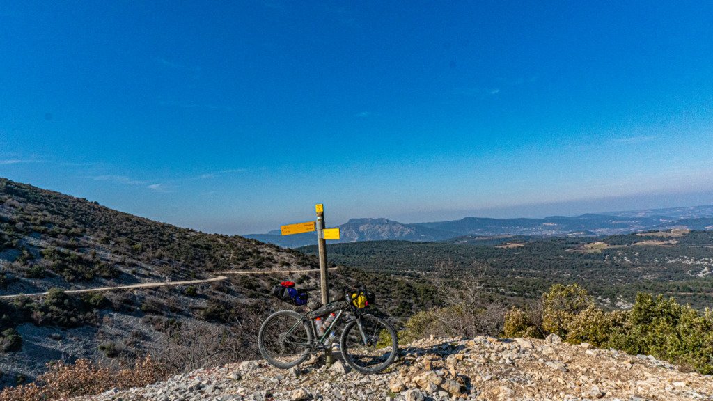
The forest track veered left at the top, a GTV sign pointed straight ahead through a gap in the trees. Where the forest road meandered down along the mountain’s contours, this trail dived straight down into the shallow gorge, hugging it’s rockface, along rocky, technical singletrack, across scree slopes, catching the tail end of the day’s light. No place for a tyre losing air! This became a theme of the GTV. Anytime a sign pointed back down through the trees after a climb, you broke out into a grin, in the knowledge that it was going to be an exhilarating singletrack ride back down.
Forest singletrack dropped you onto the back road to Malaucène, but the route soon hung a sharp left after Beaumont de Ventoux, back up for a brief excursion along wooded trails before heading back into the centre of town, arriving not long before curfew. With shops closing up, there wasn’t any chance of sourcing all the necessary part to set the tyre back up tubeless that evening.
04
I had planned a night in a gîte in Le Barroux at the Mas de la Lause as this ride was as much about meeting the local people as well as the trails. Le Barroux was 30km away by trail, but only 6km by road. Nearing curfew, my hosts kindly insisted on picking me up. A homely gîte d’hôte where I was well fed that evening and at breakfast, chatting to the owners about the GTV and local life. Returning to Malaucène in the morning was not only essential to fix the tyre issue, but also about returning to the spot where I left the route and I was rewarded with some inspired riding over that 30km back to Le Barroux,

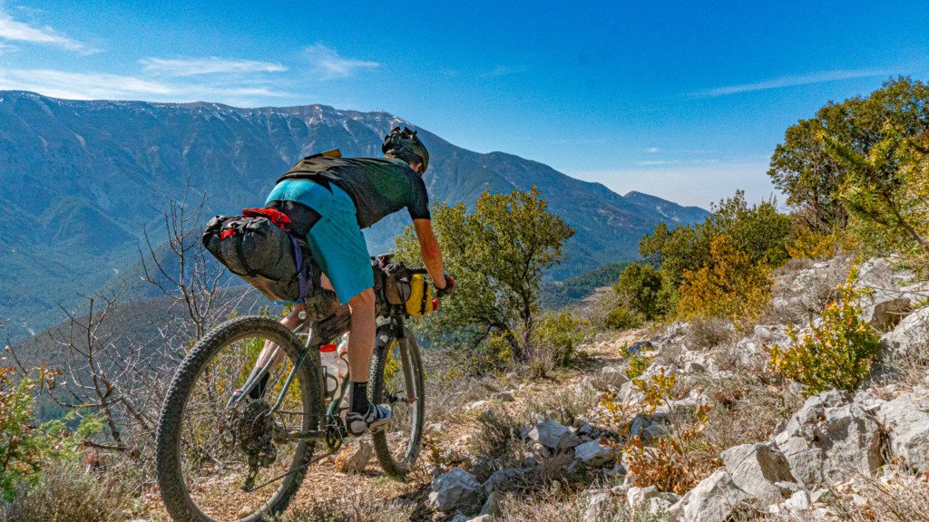
That short distanced packed in a huge amount of fun trail riding, past local vineyards with views of the Dentelles de Montmirail. The 120mm travel and stiff chassis of the Suntour Axon-Werx 34 fork was a sound choice given the terrain and the tight singletrack requiring some sharp manoeuvring. Early inter season meant the trails were devoid of hikers, barely seeing another soul all day, only the odd hike-a-bike section to negotiate.


Once back at le Barroux, the usual expectation is to pick up water from the village’s fountains, but both were labelled ‘non potable’. Asking a local resident, she worked at the Mairie and kindly allowed me to fill up from the bathroom. Taking heed of the caution sign on the descent out of the village was a good idea, the trail suddenly becoming portage down steep stone steps to the road! Across the road, wooded singletrack flowed past the local reservoir and onto a loose, stoney descent down into the valley.
05
The trail climb back up pops you out at the lesser known, little Col de la Madeleine between Malaucène and Bédoin. A couple of kms fly by on the tarmac before veering off further downward off road, towards Bédoin. Crossing the road again about 1.5km above the town is the start of the gravel climb up the infamous Mt Ventoux. Depending on your fuel/water reserves and timing, a quick visit to Bédoin is recommended as it’s an exposed 25km climb to Chalet Reynard and the 30km back down to Sault isn’t a straightforward desecent either. Beside, there is an awesome boulangerie on the main street if you enjoy cake or a large supermarché 500m away. This out of season, there was only water at C. Reynard, but in season the café normally does sell food as well.

The climb starts gentle enough, settling into a constant gradient, but the loose, over sized gravel grabbed at tyres, legs pushing hard for the little reward in forward momentum. Once above 1000m the grand views started to fade behind the increasingly dense cloud that lingered around the summit. The higher tracks smoothed out at least, the effort having masked just how much the temperature had dropped, until I started to descend from the high point 130m above C.Reynard, the cold air stinging exposed legs and arms, soon having to stop to put arm warmers on. The lingering snow in more sheltered spots should have been a clue!

With curfew time closing in (not that anyone was going to be checking up here) and wanting to make the most of the vtt descent, riding it in daylight, I pitched the MSR Reflex tent amongst the trees within the small residential area, trying to shelter from the increasingly gusting winds as much as possible. A pitch further up the track would have offered a grand view, but fully exposed to those strong winds, which didn’t let up all night. At least it dried the overnight rain off the tent outer by morning.

06
It was straight into wooded singletrack after breakfast, the trail head right opposite C.Reynard. The trail meanders its way around the mountainside, with some no fall sections of singletrack, not that you’d roll too far down the mountainside, trees eventually stopping you. It’s not straight down, with some minor climbs just to keep the legs awake.


07
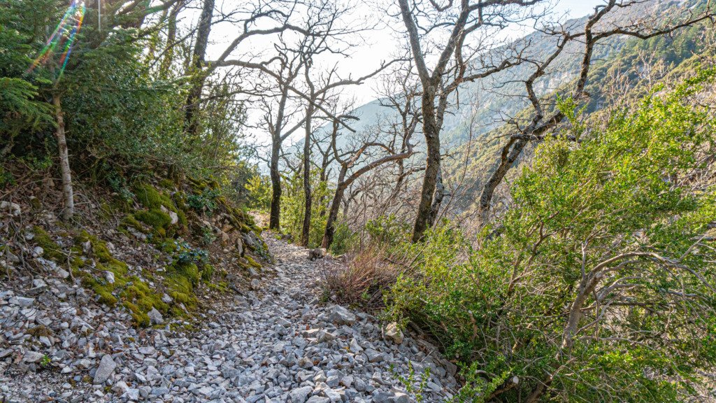
Once off the steeper slopes, the lower singletrack is loamy and fast, flowing down through the trees.


Arms pumped by the valley bottom, it’s a short climb back up and through the small village of Aurel and a flat spin to the eerily quiet Sault.


Used to the bustle of cyclists and tourists here, it was certainly an odd experience, virtually every town centre establishment closed. There is a water tap outside the la Promenade restaurant should you pass through out of hours and a large supermarket 1.5km away at the top end of town which is open into the evening. Although it’s only 55km to the next refuel spot, the tech terrain is a fun ride, but not fast going, so you might want to time your arrival to Sault as a main refuel stop.
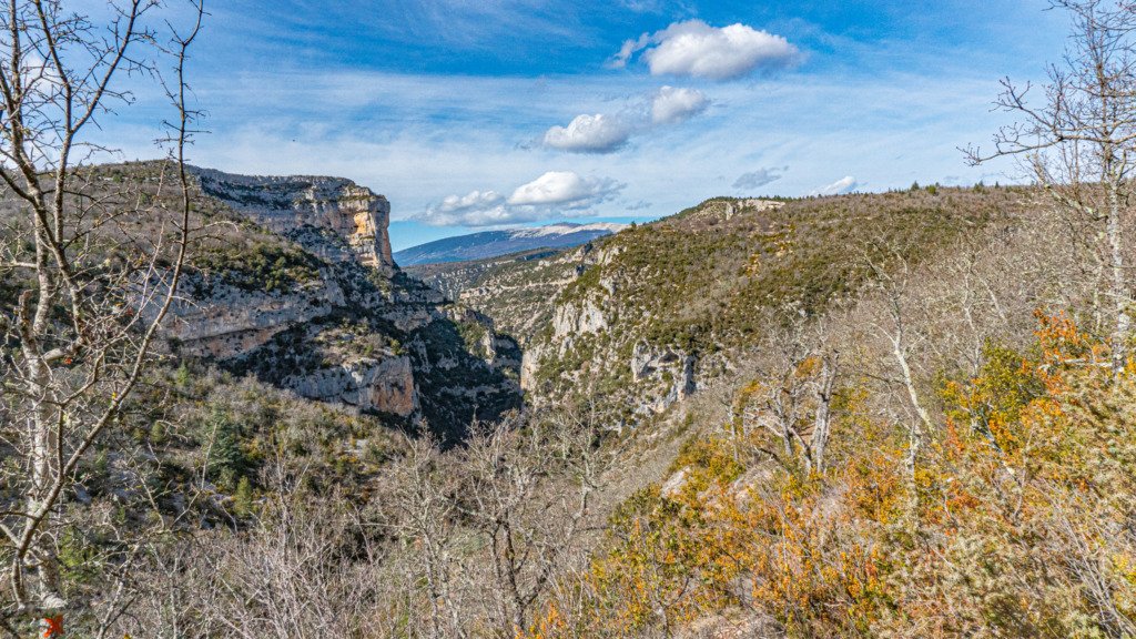
Towards Monnieux the km tick along flat, quiet country roads, arriving at the edge of the spectacular Gorges de la Nesque. The off road route is also the hiking path so care will need to be taken in the popular summer months, but this time of year I only came across 2 other people along its length. True to this half of the route, it’s a rough ride, singletrack, tech and committed in place, portage depending on your skill level.


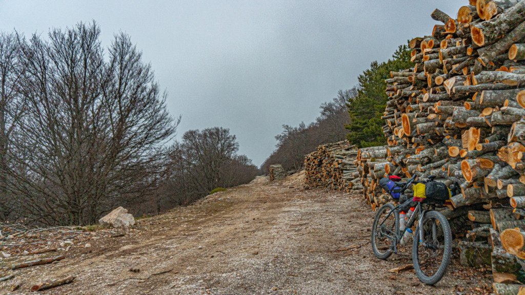
The trail heads south away from the road’s direction, becoming an open track past lavender fields, still bare stalks this early in the year, but in full bloom come mid June. The route continued along gravel tracks meandering through the forest, but this isn’t a gravel bike route, soon veering off onto more mtb appropriate singletrack.


08
St Saturnin Lès Apt wasn’t that far off at all as the crow flies, but the route continued to take in the best of the trails to get there, along rolling singletrack that tracked its way along the hillside contours, dropping in and out of the numerous forested gullies.


Not wanting to arrive into St Saturnin after curfew, a flat area on a forest track at the highest point above town offered an ideal spot to pitch camp. Right opposite the start of the singletrack descent that disappeared into the trees. Lacking a view of town over the next valley, but a stunning view of forested, rolling hills as far as the eye could see none-the-less.
Even though this spot was only half the height of C.Reynard, it was actually colder with a fine layer of frost covering everything in the morning. At least there was no wind!


